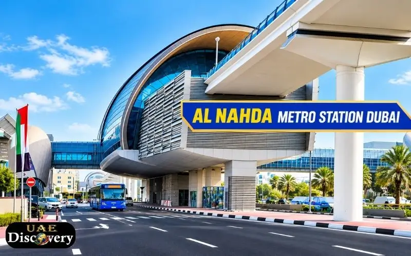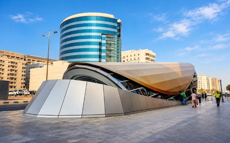
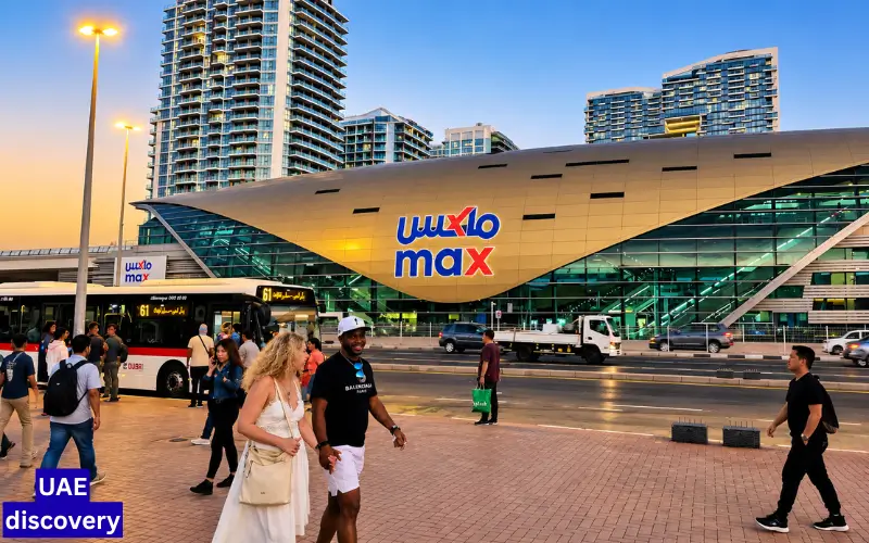
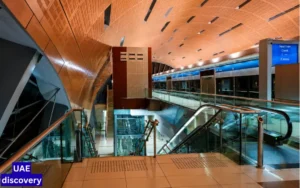
MAX Metro Station, also known as the Red Line Station of the Dubai Metro, is located on Sheikh Khalifa Bin Zayed Road . It serves Al Jafiliya & Al Kifaf in Dubai. According to the current Roads and Transport Authority Metro map, it is R21. In 2021, the station was renamed MAX from Al Jafiliya Station. This station is especially useful to reach Zabeel park, Dubai Frame and Dubai Garden Glow. Government offices, nearby residential and commercial areas are also easily accessible.
There are also several bus services that connect to the station. A map of the RTA station area published in June 2025 shows E102 and F09 around MAX Metro Station, and the Al Jafiliya Bus Station.
MAX Metro Station: Quick Guide for Travelers
| Information | Details |
| Station name | MAX |
| Former name | Al Jafiliya |
| Station code | R21 |
| Metro line | Red Line |
| Location | Sheikh Khalifa Bin Zayed Road, Dubai |
| Areas served | Al Jafiliya / Al Kifaf |
| Next Red Line Station | ADCB R20 |
| Next Red Line Station | World Trade Centre R22 |
| Nearby park | Zabeel Park |
| Nearby Attractions | Dubai Frame, Dubai Garden Glow |
| Nearby bus station | Al Jafiliya Bus Station |
The RTA map shows that MAX is R21 and ADCB is R20. World Trade Centre is R22.
Where is the MAX Metro Station located in Dubai?
The MAX Metro Station can be found on Sheikh Khalifa bin Zayed Road in central Dubai, around Al Jafiliya & Al Kifaf. The station is located near several government buildings, residential developments, and major tourist attractions. In the surrounding area, you will find Zabeel park as well as Dubai Garden Glow. On the RTA station area map, you can see the General Directorate of Residency and Foreigners Affairs as well as the Dubai Municipality Al Kifaf and Bur Dubai Police Station.
The station is useful for more than just Metro travel. It can be used by visitors to start their journeys, and residents and employees for accessing offices and neighbourhoods nearby.
Why Was Al Jafiliya Metro Station Renamed MAX?
Originally, the station was known as Al Jafiliya Metrostation. In 2021, it was renamed MAX after an agreement with the MAX Fashion brand. The station is now identified by RTA as max or R21. Older maps and articles might still refer to the station as Al Jafiliya. It is important to note that both names may appear in older information. You can find the station on older maps that was previously known as Al Jafiliya Metro Station. It is now called MAX.
Which Line Does MAX Station Serve?
MAX is a part of Dubai Metro Red Line.
The Red Line is arranged in the following order on the RTA Metro map:
ADCB — R20 – MAX — R21 – World Trade Centre — R22.
The station is ideally located for passengers traveling between central Dubai, Bur Dubai and the other destinations on the Red Line.
The Red Line continues to run in both directions towards major areas of Dubai including Downtown Dubai Business Bay Dubai Marina and Expo 2020. The exact route will depend on the destination and direction.
MAX, unlike Union and BurJuman is . It’s not a Red/Green Line interchange station. Normaly, passengers who require the Green Line must change at a station like BurJuman and Union.
MAX Metro Station Timings
Dubai Metro operating times are determined by RTA. They can be changed for special events, holidays and other operational reasons.
The RTA Metro timetable includes the following operating hours.
| Day | General Metro operating hours |
| Monday to Thursday | 5:00 AM to 12:00 PM |
| Saturday | The following day, 5:00 AM to 1:00 AM |
| Saturday | 5:00 AM to 12:00 PM |
| Sunday | 8:00 AM to 12:00 PM |
This is general Red Line and Green Line operating hours rather than a guarantee for the first or last MAX train. RTA encourages passengers to plan their trips using the most current information.
Do MAX train schedules change?
You can. RTA can publish Metro schedules that are specific to public holidays, Ramadan or other events. RTA’s latest timetable is recommended for passengers who travel very early in morning or late at evening.
It is important to remember this when MAX is used in conjunction with a longer journey that involves a bus stop.
Bus Routes at MAX Metro Station
MAX’s connection to Dubai’s bus system is one of its most useful features.
The RTA station area map, published in July 2025, lists the following bus routes around the MAX Metro Station:
- E102
- F09
- 10
- 27
- X94
- 32C
- 29
This same RTA map also shows nearby Al Jafiliya Bus Station as well as taxi and bus stops around the Metro station. Bus routes and schedules are subject to change. Passengers should not plan a trip based on an outdated route list. Before travelling, it is important to check the latest RTA schedule or S’hail information.
F09 Feeder Bus
F09 is a feeder service associated with MAX. According to current station information, the route connects the station to destinations in the Dubai area including Zabeel park and other locations. Passengers should consult the RTA’s current service information for a specific departure.
How to get to Zabeel park
MAX Metro Station provides easy access to Zabeel park. The RTA station area map specifically identifies Zabeel park near the MAX along with Dubai Garden Glow, and other attractions.
Zabeel Park in Dubai is a large park with several attractions. The walking route depends on where you want to go in the park, and which exit you use. It is important to know the walking route if you are planning to visit the Dubai Frame. The entrance is located inside Zabeel park.
Dubai Frame From MAX Metro Station
The Dubai Frame, one of the most popular attractions in the MAX area. Visitors travelling to Zabeel park and the Dubai Frame often use MAX. The Dubai Frame is listed as one of the major attractions in the area by the current local station information. Check the signs and maps to find the best exit before leaving the station. Distances and walking routes can differ depending on whether you are entering Zabeel park or Dubai Frame.
It is important to note that the Metro station is not located directly within the Dubai Frame attraction. There is still a walking section required.
Dubai Garden Glow
Dubai Garden Glow Another attraction in Zabeel park is Dubai Garden Glow. Dubai Garden Glow is identified on the RTA MAX Station Map as a nearby attraction.
Dubai Garden Glow is a seasonal attraction. Visitors should consult the official schedule of operations before making a trip. You should not rely on an old Metro article to determine its opening hours and dates.
Government Offices Near MAX
MAX can also be used by people who visit government buildings in Al Kifaf or Al Jafiliya.
The RTA station area map shows several locations that are government-related around the station.
- General Directorate for Residency and Foreigners
- Dubai Municipality Al Kifaf
- Federal Authority for Identity and Citizenship
- Bur Dubai Police Station
- Ministry of Economy
- There are several consulates
Residents and visitors alike can use the station to get to government offices located in this area of Dubai.
Each government organization can set its own requirements for appointments, entry and working hours. Before visiting, travellers should confirm the exact details of the office.
Facilities Available Around the Station
The RTA station-area map includes several passenger facilities that are associated with MAX.
- Metro access
- Bus Connections
- Taxi services
- Nol Card Top-up
- Customer service
- Elevator
- Metro exits
- Bus Stop Facilities
Station information from third parties also includes features like lifts, escalators and ticket machines, as well as passenger information facilities. It is best to check the most recent station information by contacting RTA, as station layouts and services can change.
Nol Card and MAX Metro Station
The Nol Card is used by passengers to access Dubai public transportation system. Make sure that the card is loaded with enough money to cover your entire journey before entering the Metro. The applicable fare for a transfer between Metro and Bus services depends on your journey, zone, and product Nol.
It is best not to set a fixed MAX fare before checking the RTA fare system. Metro fares are determined by the number of zones and type of ticket or Nol card used. RTA offers a number of tools that allow passengers to check their trip and fare before they travel.
What can you do with MAX?
MAX can be used for a variety of trips.
For Tourists
The station offers:
- Zabeel Park
- Dubai Frame
- Dubai Garden Glow
- Dubai World Trade Centre
- Hotels and attractions nearby
These stations are identified as the key destinations in MAX’s local area by current station information.
Residents
The station is located in Al Jafiliya, Al Kifaf, and offers access to taxis, buses, and the Red Line.
for government appointments
The location of the hotel is convenient for those who travel to GDRFA, Dubai Municipality and other offices nearby.
Nearby Metro Stations
Two Metro Stations directly adjacent to MAX along the Red Line:
ADCB – R20
ADCB is a Red Line station that comes immediately after MAX on the RTA station order.
World Trade Centre — R22
World Trade Centre is on the Red Line. It serves the Dubai World Trade Centre and the surrounding business district.
By knowing the stations that are nearby, passengers can confirm they’re travelling in the right direction.
Is MAX metro station good for tourists?
You can, especially if your main destination is in the vicinity of Zabeel park, Dubai Frame or Dubai Garden Glow. This station is not as useful for those attractions located in a distant part of Dubai. Passengers may have to transfer or continue the Red Line to reach these destinations.
Combining Metro, buses, and taxis, the station is a convenient transport hub for those exploring central Dubai.
Tips to Consider Before Traveling
Simple checks will make your journey much easier.
Be sure to check the station name. Some older websites may refer to it as Al Jafiliya while the RTA map currently identifies it by the MAX, R21.
Verify the direction of the Red Line. ADCB World Trade Centre is the next station in the sequence.
Before leaving, check the bus route. RTA’s station-area maps lists multiple bus routes. However, route schedules are subject to change.
To find attractions, use a map. Zabeel park is a large area. Your final walking route will depend on your destination.
Please check holiday schedules. Metro hours may differ during special schedules.
Have your Nol card ready. It makes it easier to travel by Metro and public transport.
Read Also: Salah Al Din Metro Station
Conclusion
MAX Metro Station in central Dubai is an station on the Red Line. It’s a great option for those travelling to Al Jafiliya or Al Kifaf. On the current RTA map, it is identified as R21 with ADCB R20 on either side and World Trade Centre R22. The station is ideally located for those who want to visit Zabeel park, Dubai Frame, and Dubai Garden Glow. RTA’s map of the station area also shows bus connections including E102. F09, 10, 27, 32C and 29.
Check the RTA schedule before you travel to get the most up-to-date information on your journeys, buses, and Metro, especially during holidays or special events.
Frequently asked questions
What is the code for MAX Metro Stations?
MAX is identified on the current RTA Metro Map as R21 along the Dubai Metro Red Line.
What was the old name of MAX Metro Station?
MAX used to be known as Al Jafiliya Metro station. In 2021, the station was renamed MAX.
What Metro line does MAX run on?
MAX is located on the Dubai Metro Red Line. ADCB R20 is adjacent to World Trade Centre R22.
What attractions are nearby MAX Metro Stations?
Nearby are Zabeel park, Dubai Frame and Dubai Garden Glow. On the RTA map, you can also see nearby government buildings.
What buses run near Metro Station?
The RTA station area map published in June 2020 lists E102_ F09_ 10, 27, X94_ 32C and 29 around Al Jafiliya Bus Station and the station.
What are the Dubai Metro general timings?
RTA lists the general Metro hours as from 5:00AM to midnight, Monday through Thursday, 5:00AM to 1:00AM the next day, Friday, 5:00AM to midnight, Saturday, and 8:00AM to midnight, Sunday. There may be special schedules.
How far is Dubai Frame from Metro Station?
Yes. MAX is a Metro station that allows access to the Dubai Frame area and Zabeel park. After leaving the station there is a walking section required. The best route will depend on the exit of the station and the entrance to the attraction.